Port: Belhaven (35.56N 76.63W)
HAPPY BIRTHDAY DADDY!!!!
Our Weather

Sunday, November 30, 2008
Saturday, November 29, 2008
Day 14: November 29, 2008
Port: Belhaven (35.56N 76.63W)
Weather: Rain! Winds N-NE 5-10, with overcast skies, turning to rain this afternoon. Seas were 1-2 feet. Temperatures reached 51 degrees F here today with a low tonight of 48. We are getting warmer!
Today started with a little craziness! This morning, instead of waking up to the alarm, we woke to a halyard clanking. Now halyards clank sometimes, but not ours. We have been very careful not to let them bang around, partially because it will drive other people crazy, but also because it drives us completely crazy. Turns out, upon quick inspection, we were stern to the wind at anchor. For those who don’t know… that’s not good. We are supposed to swing so that the bow is always into the wind. Everyone else was bow to the wind. We weren’t moving. We guess we were caught on a stump, because once we let a little more anchor chain out, we moved forward and swung around properly. Whew! At least that wasn’t something too bad. We motored 33 statue miles to MM 135 and have docked in a small marina. The rain started coming down just before we came in and is supposed to continue through Monday. We plan to hunker down for a day or two here, not only because of rain, but also because the winds are supposed to reach 25.
GWHS!
Day 13: November 28, 2008
Port: Alligator River (35.68N 76.05W)
Weather: Winds were SW-W 5-10 with overcast skies. Seas were 1-2 feet decreasing to less than 1 foot by the afternoon. The temperature was 60 degrees F, dropping to the 30’s in the evening. We had some sunshine late afternoon that was pleasant.
Up early, we headed down the ICW from MM 50 to MM 102. A long day, we traveled about 52 statue miles. Nothing very exciting happened today. We took turns steering through the channel, the landscape an endless mass of dead trees mixed with some shrubbery and an occasional live tree. We believe the land is all marsh. There were hardly any houses at all. We had to hail one bridge opening at the Alligator River Bridge (MM 85), but other than that… it was a chug chug chug kind of day. We anchored at Deep Point in the Alligator River, along with 3 other boats headed south.
GWHS!
Thursday, November 27, 2008
Day 12: November 27, 2008 (Leaving our home, Good Old VA)
Port: Coinjock, North Carolina (36.34N 75.93W)
Weather: Today was clear skies, calm wind coming out of the W at about 5-10 mph. The high for today was 58 degrees F!!!! YAY! And the low so far has been 41, but was much colder this morning. We actually felt warm! The humidity averaged 62%. Tonight, the weather is supposed to pick up with winds coming from the South at 6-8 mph and predicting the temperatures at 60 tomorrow!! Wish us that kind of luck! :)
HAPPY THANKSGIVING! We miss not being able to share the holiday with our friends and family, but wish everyone a wonderful day! We are so thankful for all the wonderful friends and family we have and for all the help they have given to us this past year and a half. We love you all so much!
Also today, we are so thankful that we were able to have Emily in our lives for as long as we did and miss her so much! We know that she is with us today, and everyday, helping us to sail this boat south and get through each and every day. We love you Boo and miss you so very much!
Today, we left dock a little later than normal, around 740, with frost lining the paint on our boat and the planks on the dock. It was so cold; we could see our breath in the cabin of the boat. We had to be very careful not to slip. We were very happy to see that no one had bothered us, since the marina was abandoned and had posted “No Trespassing” signs. We felt that we could wiggle out of trouble if the need came. I mean, they did still have a sign posted (bigger, I might add too) that said “Transients Welcome.” I’d say that one took precedent in this matter. I would hope the law would too. :) As we were untying, Bedouin, a smaller sloop, also from Herrington, passed us. We haven’t actually met the owners of Bedouin, but we have seen the boat several times. It appears we will be hopping down the ICW together, which is pretty neat. Maybe we will be able to meet them at some point.
I made us some breakfast on the go this morning while Mom drove us down the narrow channel in North Landing River. North Landing River is a very wide body of water, but only has about 6 feet of water, getting less as near the edges. In the narrow channel, which is very well marked, you have about 10 feet, but know it quickly when you stray outside. Along the way we crossed the line from VA to NC!!! That makes 3 states we have sailed through! YAY!!!!!!!!!!!! While Mom was driving, we both perceived this marker to be a red triangle, meaning we needed to keep it to our right (starboard) side. It was covered with Cormorants, a small bird that actually swims like a fish. There were so many it had distorted the shape of the marker. Mom and I had the boat way outside the channel, needless to say. We fixed it without a problem and kind of laughed when we realized the mistake we had made. From then on, we used binoculars to confirm the shape of the markers and direction we were supposed to go.
The cormorants are a strange bird. They can swim like a fish, look a little a duck. They can actually dive and stay underwater for an extraordinary amount of time. Migratory birds, we have seen them in the spring and again this winter, but they headed north for the summer. Today, they stood on every marker watching us as we went by.
During our trip today, we officially switched over from using nautical miles and knots to miles and miles per hour. We will now, until we are out of the ICW being using miles and mph to record our distance and speed.
It is amazing the change of landscapes that we have seen in the past two days. We went from open bay to the city landscape of downtown Norfolk to the outback wilderness of the ICW and now back again into more populous places. We had grassy, marshy meadows, turning to sandy knolls with some low shrubbery. The beach is just East of us, though we cannot see it. I do not believe that we will get to at all, but just knowing it is that close gives us a smile! To aid in the landscape, there were several several sunken boats of various kinds. There was one with the curtains still in the windows. We were talking and could not believe that whoever went to all the trouble of marking the ship wrecks and posting warning markers about them, but not clean any of them up. We determined the owner of the boat wanted the insurance money, and the EPA hadn’t caught on yet. It was daunting to see so many scattered along the edges though… made us want to really stay in the channel.
We stopped in Coinjock at the Coinjock Marina, a nice stop and go kind of place. We were only going to stay for ice and a potty break then head onto Broad Creek for the night, but decided to just stay here for today. It was a really short day today. We only traveled 22 statue miles and ended by 1140 this morning. We wanted to have access to the internet, power, showers, a little general store (with amazing homemade hot dilly beans and relish), and have the time to enjoy an afternoon of relaxation. Tomorrow will be a long day as a result but we decided it was worth. Hey, it’s a holiday!
Instead of turkey, we will be having jumbalaya (no seafood, didn’t think it would make it). The weather was so nice this afternoon, we kicked open all the doors and allowed the fresh air to flow through, something we hadn’t thought about or wanted to do until now. Mom even took a seat in a small Adirondack on the dock and took a nice nap in the sun. Dad and I repaired the speaker wires and I cleaned the inside of the boat. You would not believe how dirty. EW!
Well, we are wishing you all a very warm, nice Thanksgiving! It’s up early tomorrow and off to the next stopping point.
GWHS!
Day 11: November 26, 2008
Port: Pungo Ferry, the VA Pungo (36.63N 76.05W)
Weather: Today’s weather was clear skies, calm wind, and temperatures of 50 degrees, dropping to 27 degrees F during the evening/night. The humidity averaged 57%.
What a day! We made it through so many cool things today. It will take an hour to write this blog.
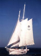
Today we left Little Creek and had to cross the Chesapeake Bay to the Elizabeth River. The cross over was very windy and cold, probably some of the coldest (other than the trip to Deltaville) we’ve been. We crossed over the Hampton Roads Tunnel which was a little strange, having drive through the tunnel. We passed Fort Wool, which after researching we found was built in 1826. Robert E Lee himself was one of the engineers of the Fort. It took a long time to build, but was never finished according to original plan. They put an experimental, supposed awesome gun at the Fort, which fired at the Confederates during the Civil War, but did no damage to them. All in all, it’s a pretty neat looking fort on a man-made island of rocks. After that we came to the Elizabeth River, which is covered on both sides with Navy and other government property. We started with all the large ships, coming to the sub pen, and wound down to more tankers and supply boats. It was so neat to see them all. I probably took 400 pictures today and they are all of Navy gray. Passing downtown Norfolk, we saw the Nauticus museum with the USS Wisconsin, which Scott and I toured on last year. We also passed a beautiful 3-masted schooner sitting at dock. To make this a little shorter, we came to the red buoy 36, which marks Mile Post 0 of the ICW. We officially started the ICW at Hospital Point in Norfolk. Shortly after that, we hailed our first bridge opening by VHF. It was very neat to see (there is a video). We hailed several more bridges today and completed a lock (Great Bridge). There are pictures for all the bridges and some video. My favorite is Great Bridge, which is the green one. Dad and I made a bet on the swing bridges as to which way they would swing. He won on the first bridge, I did on the second. We like it when we both win.
Now for the story behind the Naval powerboat with the guy who yelled at us. It was more a warning… that we were too close. Haha… we couldn’t help it. We wanted to see more, so we drifted, I guess, too close to some invisible boundary that marks the ICW from the Navy. He came zooming out and told us to back away and stay further out. The soldier riding with him glared at us for some reason. I didn’t think we were doing anything wrong. I was taking pictures of everything, so maybe he didn’t like that.
Also, another special treat… we saw the USS Simon Lake. For those who do not know, the USS Simon Lake is a submarine tender on which my grandfather, Gil, was an XO. The USS Simon Lake was decommissioned in 1999 and has been sitting here in Norfolk. It was so exciting to see the ship that Gramps had worked on. For my mom, it brought back many memories, especially a relevant one about a Thanksgiving dinner on board. Pictures are posted. For those wondering what the E means, it’s on a caption of the one picture.
Tonight, we managed to get to MM 28.5 and docked at an abandoned marina in Pungo Ferry, VA. There is a Pungo Creek and Pungo River in North Carolina, so it gets confusing. The marina was apparently the first marina established in the state of VA, but had since closed down. It was a little spooky. There was nothing around it, but trees and bare land. We couldn’t even see any town nearby. We docked at the still very stable dock for tonight. All in all we traveled 41.3 miles, a long day, and had a blast seeing everything.
GWHS!
Weather: Today’s weather was clear skies, calm wind, and temperatures of 50 degrees, dropping to 27 degrees F during the evening/night. The humidity averaged 57%.
What a day! We made it through so many cool things today. It will take an hour to write this blog.
Today we left Little Creek and had to cross the Chesapeake Bay to the Elizabeth River. The cross over was very windy and cold, probably some of the coldest (other than the trip to Deltaville) we’ve been. We crossed over the Hampton Roads Tunnel which was a little strange, having drive through the tunnel. We passed Fort Wool, which after researching we found was built in 1826. Robert E Lee himself was one of the engineers of the Fort. It took a long time to build, but was never finished according to original plan. They put an experimental, supposed awesome gun at the Fort, which fired at the Confederates during the Civil War, but did no damage to them. All in all, it’s a pretty neat looking fort on a man-made island of rocks. After that we came to the Elizabeth River, which is covered on both sides with Navy and other government property. We started with all the large ships, coming to the sub pen, and wound down to more tankers and supply boats. It was so neat to see them all. I probably took 400 pictures today and they are all of Navy gray. Passing downtown Norfolk, we saw the Nauticus museum with the USS Wisconsin, which Scott and I toured on last year. We also passed a beautiful 3-masted schooner sitting at dock. To make this a little shorter, we came to the red buoy 36, which marks Mile Post 0 of the ICW. We officially started the ICW at Hospital Point in Norfolk. Shortly after that, we hailed our first bridge opening by VHF. It was very neat to see (there is a video). We hailed several more bridges today and completed a lock (Great Bridge). There are pictures for all the bridges and some video. My favorite is Great Bridge, which is the green one. Dad and I made a bet on the swing bridges as to which way they would swing. He won on the first bridge, I did on the second. We like it when we both win.
Now for the story behind the Naval powerboat with the guy who yelled at us. It was more a warning… that we were too close. Haha… we couldn’t help it. We wanted to see more, so we drifted, I guess, too close to some invisible boundary that marks the ICW from the Navy. He came zooming out and told us to back away and stay further out. The soldier riding with him glared at us for some reason. I didn’t think we were doing anything wrong. I was taking pictures of everything, so maybe he didn’t like that.
Also, another special treat… we saw the USS Simon Lake. For those who do not know, the USS Simon Lake is a submarine tender on which my grandfather, Gil, was an XO. The USS Simon Lake was decommissioned in 1999 and has been sitting here in Norfolk. It was so exciting to see the ship that Gramps had worked on. For my mom, it brought back many memories, especially a relevant one about a Thanksgiving dinner on board. Pictures are posted. For those wondering what the E means, it’s on a caption of the one picture.
Tonight, we managed to get to MM 28.5 and docked at an abandoned marina in Pungo Ferry, VA. There is a Pungo Creek and Pungo River in North Carolina, so it gets confusing. The marina was apparently the first marina established in the state of VA, but had since closed down. It was a little spooky. There was nothing around it, but trees and bare land. We couldn’t even see any town nearby. We docked at the still very stable dock for tonight. All in all we traveled 41.3 miles, a long day, and had a blast seeing everything.
GWHS!
Days 9 – 10: November 24-25, 2008
Port: Norfolk (36.83N 76.3W)
For the next 2 days, we stayed in Norfolk to visit with John and Betsy Morris and Scott. It was a very nice visit and enabled us to get some things fixed around the boat, such as our kerosene heater. The heater had died in the craziness of the weather, we believe because the kerosene was dirty and when shaken up, clogged it. We were able to do laundry, thank you all for that, and get some warm showers!! We were also able to grocery shop and resupply on some necessities and pump out (a nasty little job of emptying the boat of *ahem* waste). I, hahahaha, got to miss this task. Luckily, there was a Carib dealer at the marina, so we were able to replace the lost oar. We looked for it on our way to Norfolk, expecting it was still floating around. Wouldn't that have been neat to actuall find it! We enjoyed the break greatly and are ready to get back on the water to head further south.
GWHS!
Day 8: November 23, 2008
Port: Norfolk (36.83N 76.3W)
Weather: The weather today, while better than before, had winds of 9-13 mph from the East. It was sunny, clear skies, and therefore a lot warmer. The temperatures were a high of 43 with a low of 23 during the night. The humidity averaged 69%.
Today was fairly uneventful motoring, comparatively. We left Deltaville this morning around 700 for Norfolk, Va. Having had an exciting last day out, we decided to keep this day pretty cool, ie. not do anything crazy. The weather was a complete opposite of what we had coming into Deltaville, so we plunked down the bay for 43.5 nautical miles. There were light winds, small waves, and the sun was shining brightly. We just motored, keeping it simple. With the slight wind and currents pushing us along, we actually got to Norfolk a lot quicker than predicted. We worked our way to Little Creek in Norfolk and arrived at 1402 in the afternoon. We decided to stay at Cobb’s Marina, which is where John and Betsy Morris have their boat. They, thank you both so much, set it up for us to come in to the marina’s only T-dock for a few days. We hailed John on the VHF to let him know we were coming in. They would meet us at the dock to help tie us.
Right on Little Creek is the Little Creek Naval Amphibious Base. We got to watch 3 hovercrafts fly by us on the water and keep going right up the sandy beach and into the yard. It was so amazing to see them completely turn from water vessel to land vehicle. We saw so many naval vessels coming into the channel. I could have stared all day long. I love looking at all the ships and boats they have.
John and Betsy met us at the dock, we tied up, and relaxed for a bit. Mom and Dad went on with John and Betsy for dinner, showers, and laundry, while Scott came to pick me up. We will be staying here for a little bit.
GWHS!
Subscribe to:
Posts (Atom)